Geoelectric hazards
How much geoelectric field would a once-per-century magnetic storm drive through the North American power grid, and where would it hurt most?
During my Mendenhall Postdoctoral Fellowship with the USGS Geomagnetism Program, I worked on geoelectric hazards and the risk severe space weather poses to the nation's power grid. The central problem is that the geoelectric field driven by a magnetic storm depends strongly on the electrical conductivity of the ground beneath the grid — and that conductivity varies by orders of magnitude across the continent. Hazard estimates built on a uniform Earth can be wrong by a factor of ten in either direction.
To work with the magnetotelluric survey data, magnetic observatory records and grid models involved, I wrote bezpy, an open-source Python package that handles the variety of data sources and formats in this field. It is now used well beyond my own work.
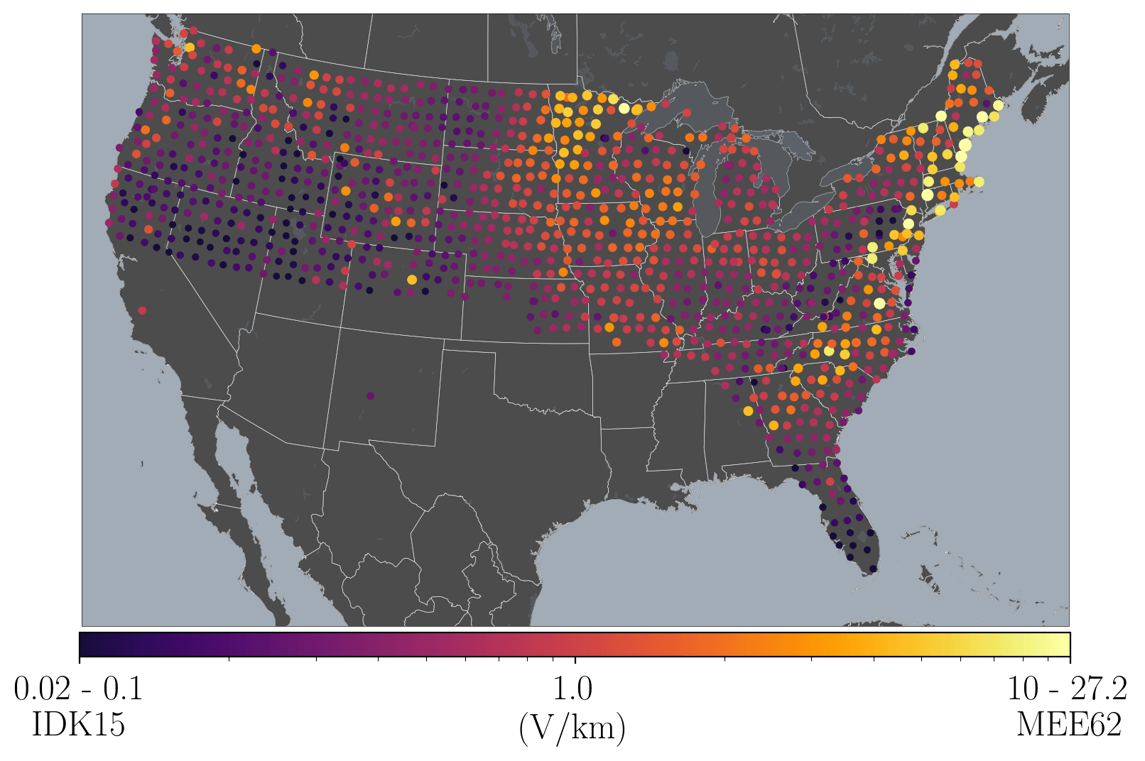
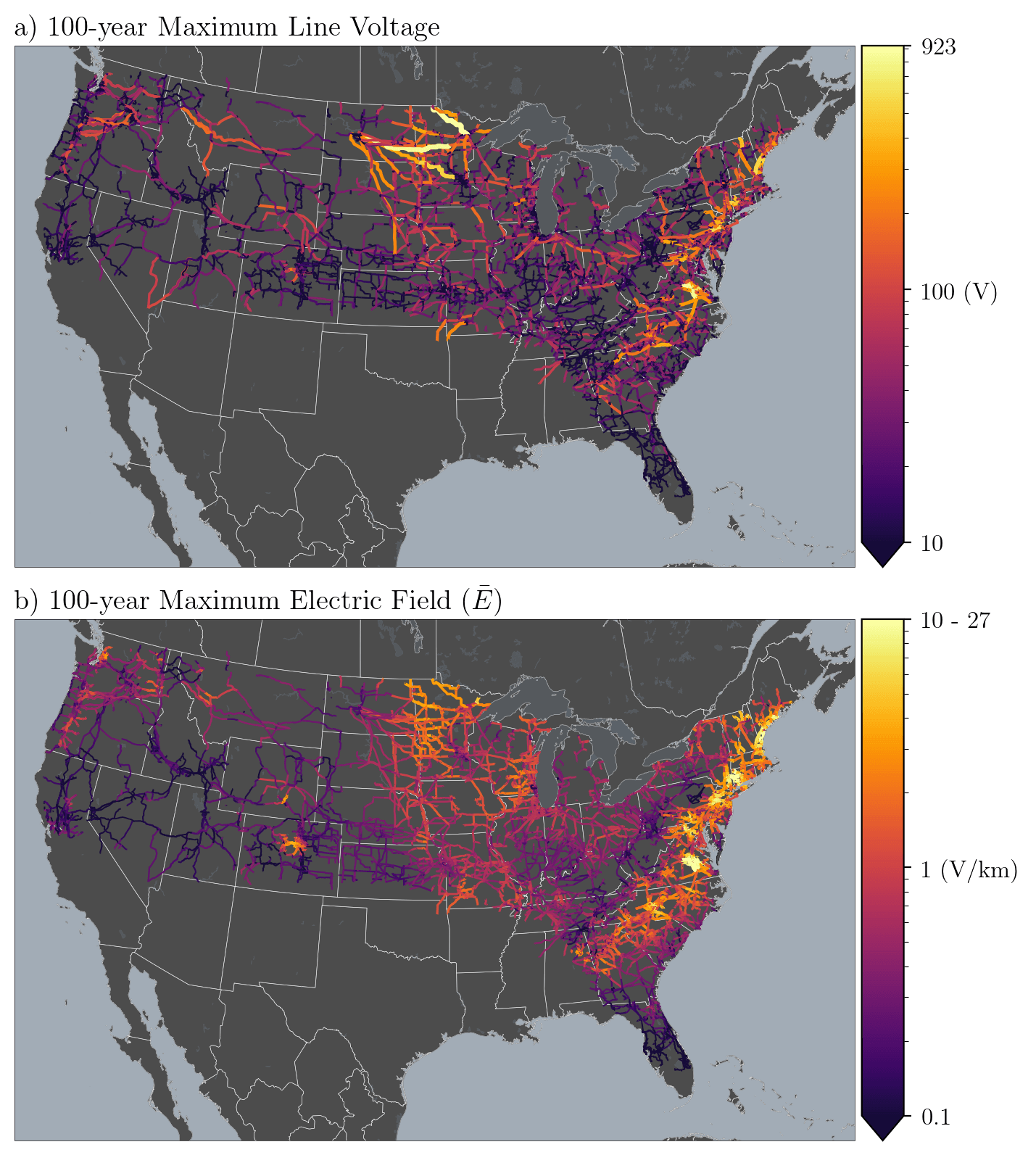
That analysis culminated in a 100-year geoelectric hazard analysis for the U.S. high-voltage power grid, which estimated the likely magnitude of both geoelectric fields and the induced voltages along individual transmission lines. To make the result checkable rather than merely citable, the full analysis is published as a Jupyter notebook in a public repository.
Historic superstorms
The same machinery can run backwards. With colleagues at the USGS I helped reconstruct the geoelectric hazard of storms that predate modern instrumentation — the March 1989 superstorm that collapsed the Hydro-Québec grid, the March 1940 storm and its effects on American communication and power systems, the May 1921 superstorm, and ultimately the 1859 Carrington event itself.
A related thread asks how well we can even measure this: whether national-scale magnetotelluric surveys sample the ground densely enough to support hazard estimation at all, and how realistic surface impedance changes the mapped E3 hazard from a nuclear electromagnetic pulse.